




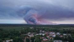
France is grappling with massive wildfires in the Gironde region near Bordeaux, leading to the evacuation of tens of thousands. These fires have triggered a rare and dangerous phenomenon known as pyrocumulonimbus clouds, often referred to by experts as fire-generated thunderstorms.
These clouds develop when intense heat from a wildfire causes air to surge rapidly upward, carrying ash, smoke, and moisture into the upper atmosphere. As the air cools at high altitudes, the vapor condenses into towering storm clouds. These formations create turbulent winds that scatter burning embers over vast distances, making the fire path unpredictable and spawning lightning that can ignite new fires.
French authorities noted that this occurrence is unprecedented in the country. The situation is exacerbated by severe heatwaves across Europe characterized by record temperatures and persistent dry conditions. With temperatures expected to reach 40C, officials warn that the Gironde blazes could persist for months.
Climate experts anticipate that such extreme weather events will become more common as the planet warms. Similar phenomena were documented during the catastrophic 2019-2020 Australian Black Summer bushfires and the 2021 California fire season. NASA has described these clouds as “fire-breathing dragons” capable of creating their own weather systems, significantly hindering firefighting efforts worldwide.